So on Friday, 11th April Howard suggested that we fly to Bellingham (KBLI) which is up near the Canadian border. He wanted me to do the ILS 16 approach there. He had already filed us to fly direct to the Paine VOR (PAE). I had done a lot of my training at KPAE where PAE is located, so it would be a gentle re-entry into under the hood single pilot IFR. He then had me flying ZAGIC-BEZOV-EGRET-ACORD-HUH (which is V-23) to BLI.
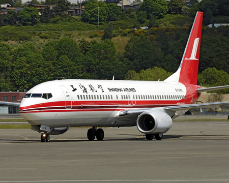
The first thing I learned was that the KLN-94 GPS does not have an airways routing option, you have to individually enter the waypoints. That took me a while! We launched off RWY 33, and since it took me so long to set up the GPS (and because we had to hold for the first flight of a Shanghai Airlines Boeing 737-800), the DG had precessed. I didn't check the DG as the last check before takeoff so the usual "turn right 350, climb to 3000 ft" departure procedure became a guessing game. Howard suggested I use the track on the GPS as a guide since the wind was calm and Seattle Approach would give me the right heading to follow (which I could estimate what heading I needed to show on the DG). This bothered my scan a little, but I managed to get the climb right. We had to climb to 6000 ft. MEAs around the Puget Sound are pretty high, this one was probably so that we could avoid the mountains south and east of KBLI.
The tracking on the airway wasn't bad though I didn't go exactly over PAE as Howard would have liked. I started preparing for the approach way ahead of time and was able to go over the checklist properly. This has usually been a problem - I really need to memorize what is required when and use the written checklist only as a backup. Not having all the checks done usually has me scrambling to set up things up while on the ILS or before intercepting the course inbound.
The ILS itself was easy - we were handed off to Victoria Terminal in Canada. The Canadian controllers sound pretty much the same as the US ones. No "ehs" and "aboots" here!
They do use different (more ICAO-ish?) terminology - "132 decimal 7" instead of "132 point 7" and "do not descend below 3000 ft" instead of "at or above 3000 ft".
My ILS approach was fine, I had to go to lower power than I am used to do 100 kts and 600 ft/min of descent to stay on the glideslope. This was because we had a slight tailwind. However close to the ground my direction control was wanting and I started making some big turns to stay on course. MUST REMEMBER TO DO SMALL CORRECTIONS. Minimums were 363 ft and Howard allowed me to take of my hood and land. We had to go to idle and full flaps to make the landing but we did make it!
I am sure a lot of people are aware of "Flightaware" which is a site that tracks airplanes on IFR flight plans and displays where they are live. It even stores the information and you can track your history by airplane tail number. My flight to KBLI was tracked and here is a graphic of it. Nice turn and intercept on to the ILS , if I say so myself!
 We then did the KIENO TWO DEPARTURE PENN COVE TRANSITION from RWY 16 at KBLI. This involved climbing to 600 ft straight ahead and intercepting the 160 radial on the WHATCOM VOR (HUH) then from the KIENO intersection and on to CVV (Penn Cove VOR). This was my first DP (Departure Procedure) and the lesson I learned was to make sure all the avionics were set up and I had visualized what had to be done before even thinking about taking off. I had to monitor two VORs (for HUH and CVV) and the intersection on the GPS. How did people do this with just one VOR and an ADF in the old days?
To cut a long story short we did the RNAV GPS 16R approach into KPAE (Paine Field or Everett/Snonomish County airfield) and then did the RNAV (GPS) 15 approach back to Renton. (Everett is where the Boeing 747s and 777s are made) I did the checks and all right but again started making big corrections directionally. I went missed and on to Renton. This time I was anticipating the turns coming up on the GPS course and was able to do them a lot better than before, though I did not start down as early as I should have. We did a circle to land from 900 ft on Renton.
Howard said that I had an "encouraging" flight and what I needed to concentrate on was being disciplined in completing the check lists and being prepared at the right time on the approach. This would prevent distractions and would lessen the multi-tasking overload at critical moments.
I resolved to do just that for the X-country the next day. I had to go look at a Bonanza that I am planning to get a share in, so I did the planning early in the morning. The MEA going to KELN is 9000 ft! I hadn't been up to that height in a while. The course is pretty direct V2-298. Since the weather was CAVU, I didn't have to plan an alternate but I planned one anyway to KMWH.
The most interesting thing about KELN is that it is in a bowl in the mountains. The DP is critical for obstacle avoidance and is pretty interesting. DPs from airports like KELN should be read by VFR pilots as well, since they can be used to ensure good obstacle clerance in VFR conditions as well. Howard wanted to fly the VOR B approach into KELN.
Amy hadn't been on a flight with me for a while. Flying around in the soup while I had my hood on wasn't something that would be much fun! But this trip was perfect since the weather was awesome and she could get views of the mountains that are spectacular. She came along for the ride.
The things I learned this flight
- To shortcut IFR procedures you can say that you can maintain terrain clearance on your own and not have to climb in a hold. We were supposed to be at 9000 ft before crossing but were cleared to go direct to BANDR intersection (about 35 nm from Seattle) given 4000, 5000, 7000 and then 9000. The terminology the control used was "7000 maintain 9000".
- The aircraft power settings are very different at 9000 ft, even in a 230 hp Cessna 182, than they are at 3000 ft. I had reached "full throttle height" by 9000 and wasn't able to maintain top of the green on the manifold pressure above 8000. So we ran the prop at the top of the green to get some speed. Of course this causes the fuel consumption to go up, but we had plenty of fuel.
- You have to pay attention to beginning your descents and keeping within the confines of the approach. For the VOR B approach we had to complete the procedure turn within 7 nm of the VOR and had to descend from 9000 ft to 5700 ft in that time and then descend to 4300 ft before the Final Approach Fix for a minimums of 3260 ft.
- Circling in a hold after takeoff to an 8000 ft MEA (from a 1763 runway height) cannot be fun in a Cessna 172, we had to do 3 turns even in the 182.
This time my checklist discipline was better but I need to really go do stuff faster. I was also waiting for coaching from Howard - and he said that he is now going to stop talking to me (I hope he meant in the air!).
Amy took a picture of us "working". Howard is probably prompting me to set up the avionics right!
 I did not see anything but the instruments and a glimpse of the runway on the VOR approach. The runway was off to the left and I did a circle to land. However here are the specatular views that Amy and Howard saw. Thats Mt Rainier off to my right. IFR flying is all well and good but missing these kinds of sights is not on!


No comments:
Post a Comment